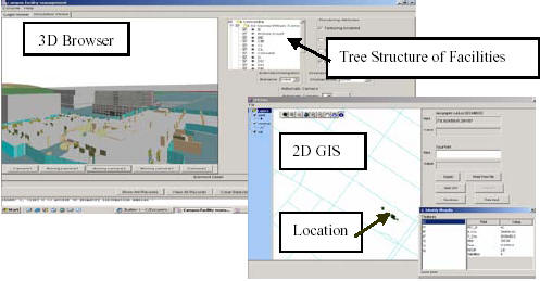
Large-scale Facilities Management Information Systems (FMIS) require integrating a great amount of information about each building, and the ability to easily locate these buildings and their components, especially when considering the potential of using the FMIS in a mobile Location-Based Computing (LBC) setting. The interoperability of these systems is of paramount importance because of the need to develop and use them by a large number of groups in a distributed fashion. Available interoperability product models, such as Industrial Foundation Classes (IFC), have several limitations with respect to the requirements of these systems. In this paper, we describe innovative methods for integrating and visualizing information for large scale FMIS and discuss the computational issues needed for creating and deploying the 3D models used in these systems. CAD models, maps and images are integrated to create the 3D model of a facility, and then the resulting model is integrated with cost and scheduling information and used to collect inspection data using mobile computers equipped with tracking devices and wireless communications. In order to realize the proposed FMIS, several standards for Geographic Information Systems (GIS), LBC and other de-facto standards are introduced for the purpose of complementing IFC in fulfilling the additional requirements of integration, visualization, and tracking. The proposed approach is demonstrated through a case study about a FMIS for a university campus.
